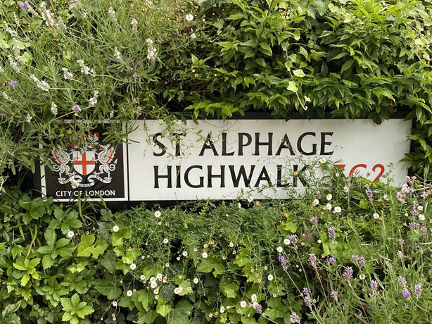
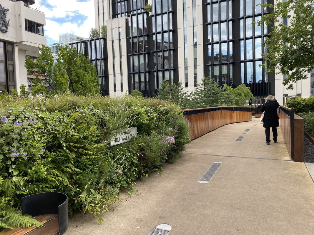
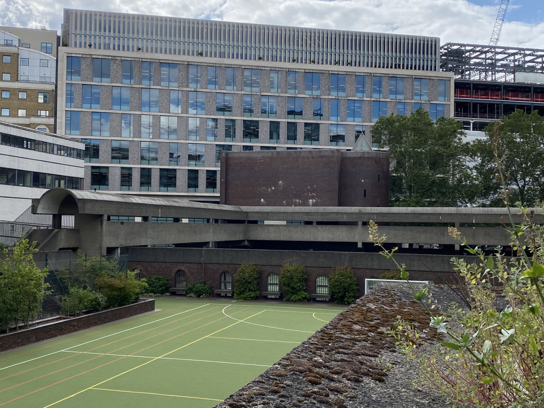
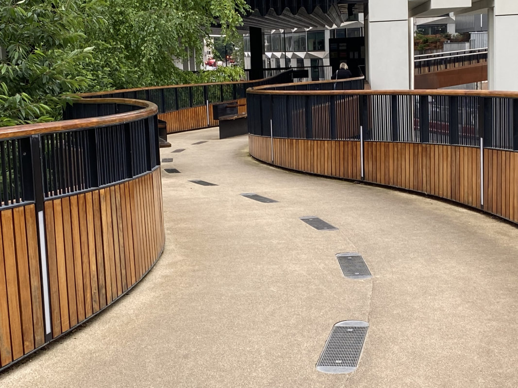
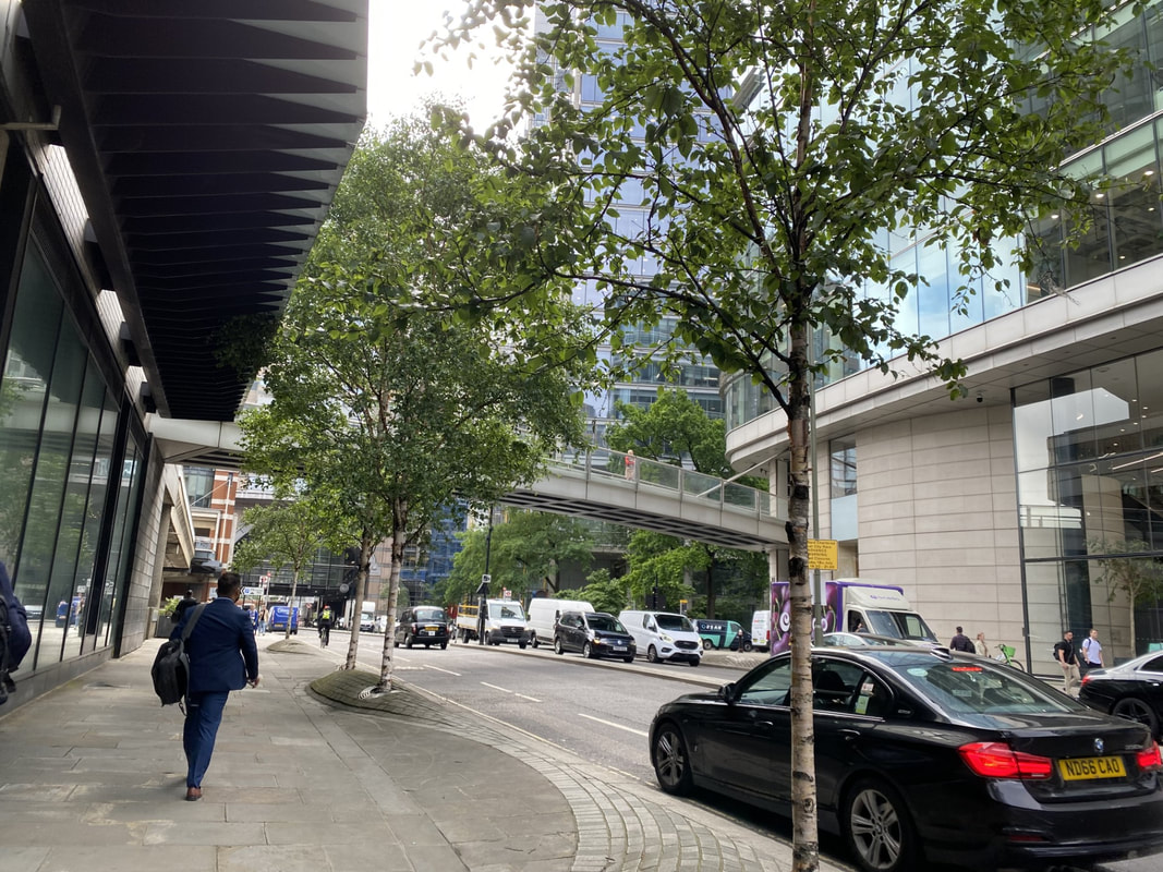
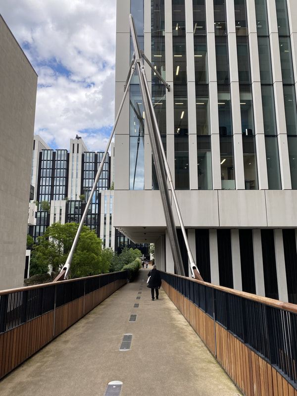
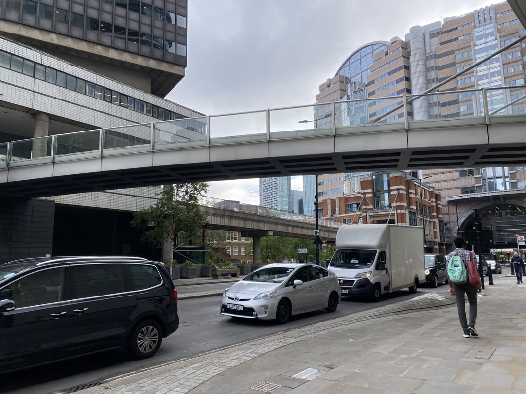
 St Alphage Highwalk newly installed green pedway above London Wall St Alphage Highwalk newly installed green pedway above London Wall I was asked to take part in a podcast about the City of London's pedway system. Little did the broadcasters know that I had written an article about them in 2017 and reproduce the article here and append the podcast link. Pedways: pedestrian paradise or ponderous paths? - Streets Ahead | Acast From 2017: You may have noticed lots of elevated walkways or bridges spanning many of the City of London roads. Indeed, you may have used them to ease your crossing. That adjacent to Plaisterers' Hall stretches across London Wall from One London Wall to the highwalk that easily leads you to the Museum of London if you turn left or El Vinos (in 2017 occupying a bar) if you turn right - depending on your taste. The arrangement of these walkways is in fact called The City of London Pedway Scheme. It is a partial elevated pedway that evolved out of a plan to transform traffic flows in the City of London by separating pedestrians from street level traffic using elevated walkways. First devised as part of the post World War II reconstruction plans for London, it was put into effect mainly from the mid-1950s to the mid-1960s and eventually abandoned by the 1980s - until now. Versions of the plan had been under consideration since the 19th century, and given shape by the German Bauhaus movement, but the scheme was only given impetus in London after World War II, during which London had suffered severe bomb damage. Enthusiasts for the scheme saw an opportunity to put it into practice through the post-war reconstruction programme, and in 1947 architect Charles Holden and planner William Holford developed a blueprint that envisaged a network of first-floor walkways that would connect buildings across the City. By the mid-1960s, the City of London Corporation had incorporated the scheme into its development plan. Although no coherent network was ever defined, designers of new developments were required to incorporate first-floor access to the pedway network as a condition of being granted planning consent. As most of the network had not been built, this meant that many developments incorporated unused "dead space" at first-floor level and partial walkways that led to dead ends. In consequence, the scheme was unpopular with many architects. The plan had the backing of city planner Percy Johnson-Marshall who compared the scheme to Venice, the city streets were like canals and the pedway the bridges over them. In reality it meant offices had two sets of receptions, one at street and one at pedway level (ever tried to get into 125 London Wall?). Shops built at pedway level found it difficult to get deliveries, shops at street level had no customers. Poor design meant the pedways were windswept and prone to flooding. As fewer people used them people feared using them creating a cycle of decline. Buildings that were required to incorporate links to the pedway included in their heyday the National Westminster Tower, which incorporated a pedestrian bridge across Bishopsgate that was never used and is now demolished; the Commercial Union building, the Barbican, and Drapers' Gardens. By the mid-1980s, the scheme had effectively been discontinued. The reason for its ultimate demise were escalating costs and the increase in influence of the conservation lobby, which opposed the extensive redevelopment of the historic areas of the City. Not to mention concerns about security due to the additional access points. The pedway scheme only succeeded in establishing itself in areas that required extensive post-war reconstruction. The most extensive part of the network to be completed was in the Barbican Estate and surrounding streets. Indeed the clue to getting around the Barbican is to access all areas via the highwalks. The main entrance to the Museum of London is, to this day, at first-floor level. Indeed this is rather a disadvantage to the Museum as many people claim not be able to find the entrance - even though there are 6 well signposted points at ground floor level leading up to the highwalk by stairs, escalators and lifts. The new Museum of London site at Smithfield will be at ground floor level and will be much more permeable - maybe somewhat of a reaction to the current high level isolation. Pedways have now returned in style with the new development known as London Wall Place. This large new office development is a few hundred yards from the Hall towards Moorgate. The development threatened to cut off the Barbican residents from their previous high level traverse to the City and thus the planning conditions imposed required the developer to reinstate and improve the pedways. These weathered-steel beauties (see photo) are the first additions to the pedway network in many years. True, they are a replacement for a demolished walkway rather than an entirely new piece of infrastructure. But their attractive, sinuous form is a far cry from the utilitarian concrete spans they replace. A film was made in 2013 about the City of London Pedway and there is a link here to this interesting piece of history and architecture. https://vimeo.com/80787092. The Pedway: Elevating London is a documentary on the post-war redevelopment in the City of London - focusing on the attempt to build an ambitious network of elevated walkways through the city. Featuring interviews with professor of town planning Michael Hebbert (UCL), architecture critic Jonathan Glancey, former City planning officer Peter Wynne Rees and writer Nicholas Rudd-Jones (Pathways), the film explores why the 'Pedway' scheme was unsuccessful and captures the abandoned remains that, unknown to the public, still haunt the square mile. It worth watching and then setting out on foot to find the lost stairways. The gentle destruction of the pedways has driven the pedestrian to the pavements and the consequential conflict with traffic. The resolution to that conundrum is more traffic free or traffic-light areas and wider pavements. A future Bank on Safety scheme is planned at the busy Bank junction and more changes that will occur with the Barbican Ultra Low Emission Zone and Cultural Hub. All of which are planned to make the City more liveable. (2023 update - these are now all in place). One wonders how they will be viewed in 50 years' time - will they, like pedways, have given way to better architectural innovations?
0 Comments
Your comment will be posted after it is approved.
Leave a Reply. |
AuthorAlison Gowman Archives
January 2024
Categories
All
|
 RSS Feed
Follow Alderman Alison Gowman on Twitter: https://twitter.com/GowmanAJ
Alison Gowman: As an elected Alderman within the City of London: https://democracy.cityoflondon.gov.uk/mgUserInfo.aspx?UID=229
Privacy policy: https://www.alisongowman.org/privacy.html
Cookie policy: https://www.alisongowman.org/cookies.html
Terms & conditions of website usage: https://www.alisongowman.org/tandc.html